Your order qualifies for free shipping!
Your shopping bag is currently empty
Continue ShoppingWORKING DAYS/HOURS:(Mon - Sun / 9:00 AM - 8:00 PM)
Which products sold the most this month?
Some of the most in-demand products.
God Particle Wargaming Mat on Sale
Pleasant Surprise Spacebar Keycap For Discount
Swamp Tales Spacebar Keycap Discount
Home Sweet Home Spacebar Keycap Sale
This Is It Spacebar Keycap Discount
God Particle Extended Mousepad Online Hot Sale
Home Sweet Home Day Tote Online now
Campaign and non-campaign and best-selling products.
~ Tom Patterson Canyon UT topo map, 1:24000 scale, 7.5 X 7.5 Minute, Historical, 1966, updated 1970 on Sale
$14.95 Original price was: $14.95.$7.48Current price is: $7.48.
Price match promise
Free delivery on all orders
Safe & secure transaction
Extended Christmas return policy
Recently Viewed
Wirehaired Pointing Griffon Christmas Reindeer Greeting Cards Pack of 8 For Cheap
~ Ethridge MT topo map, 1:24000 scale, 7.5 X 7.5 Minute, Historical, 1966, updated 1969 For Discount
Cockapoo The Chef Pair of Pot Holders Cheap
Description
Tom Patterson Canyon, Utah, USGS topographic map dated 1966.
Includes geographic coordinates (latitude and longitude). This topographic map is suitable for hiking, camping, and exploring, or framing it as a wall map.
Printed on-demand using high resolution imagery, on heavy weight and acid free paper, or alternatively on a variety of synthetic materials.
Topos available on paper, Waterproof, Poly, or Tyvek. Usually shipping rolled, unless combined with other folded maps in one order.
- Product Number: USGS-5461551
- Free digital map download (high-resolution, GeoPDF): Tom Patterson Canyon, Utah (file size: 12 MB)
- Map Size: please refer to the dimensions of the GeoPDF map above
- Weight (paper map): ca. 55 grams
- Map Type: POD USGS Topographic Map
- Map Series: HTMC
- Map Verison: Historical
- Cell ID: 45353
- Scan ID: 252443
- Imprint Year: 1970
- Woodland Tint: Yes
- Aerial Photo Year: 1965
- Field Check Year: 1966
- Datum: NAD27
- Map Projection: Polyconic
- Map published by United States Geological Survey
- Map Language: English
- Scanner Resolution: 600 dpi
- Map Cell Name: Tom Patterson Canyon
- Grid size: 7.5 X 7.5 Minute
- Date on map: 1966
- Map Scale: 1:24000
- Geographical region: Utah, United States
- Map Area ID: AREA39.62539.5-109.25-109.125
- Northwest corner Lat Long code: USGSNW39.625-109.25
- Northeast corner Lat Long code: USGSNE39.625-109.125
- Southwest corner Lat Long code: USGSSW39.5-109.25
- Southeast corner Lat Long code: USGSSE39.5-109.125
- Northern map edge Latitude: 39.625
- Southern map edge Latitude: 39.5
- Western map edge Longitude: -109.25
- Eastern map edge Longitude: -109.125
-
Neighboring Maps:
Northwest North Northeast West MAP East Southwest South Southeast All neighboring USGS topo maps are available for sale online at a variety of scales.
Spatial coverage:
Topo map Tom Patterson Canyon, Utah, covers the geographical area associated the following places:
– Black Horse Canyon – Moonshine Canyon – Gorge Canyon – Tom Patterson Ridge – Rat Hole Canyon – Taylor Canyon – Railroad Canyon – Dry Burn Canyon – West Tom Patterson Canyon – Tom Patterson Point – PR Canyon – Black Horse Point – South Canyon – Sweet Water Spring – Johns Canyon – Pole Canyon – PR Canyon – Book Cliffs Natural Area – East Tom Patterson Canyon – Black Horse Spring – Tom Patterson Canyon – McCook Ridge – Augusi Canyon – Gorge Spring – Chipeta Canyon – Moccasin Trail Canyon – Tom Patterson Spring
Additional information
Print Material Regular Paper, Waterproof, Polypropylene, Tyvek
Related products
50%Select options This product has multiple variants. The options may be chosen on the product page~ Stony Creek VA topo map, 1:24000 scale, 7.5 X 7.5 Minute, Historical, 1967, updated 1968 For Sale
$14.95Original price was: $14.95.$7.48Current price is: $7.48.50%Select options This product has multiple variants. The options may be chosen on the product page~ Whaleyville VA topo map, 1:24000 scale, 7.5 X 7.5 Minute, Historical, 1967, updated 1969 Discount
$14.95Original price was: $14.95.$7.48Current price is: $7.48.50%Select options This product has multiple variants. The options may be chosen on the product page~ Stuart VA topo map, 1:24000 scale, 7.5 X 7.5 Minute, Historical, 1967, updated 1971 Hot on Sale
$14.95Original price was: $14.95.$7.48Current price is: $7.48.50%Select options This product has multiple variants. The options may be chosen on the product page~ West Augusta VA topo map, 1:24000 scale, 7.5 X 7.5 Minute, Historical, 1967, updated 1991 For Cheap
$14.95Original price was: $14.95.$7.48Current price is: $7.48.50%Select options This product has multiple variants. The options may be chosen on the product page~ Stuart VA topo map, 1:24000 scale, 7.5 X 7.5 Minute, Historical, 1967, updated 1971 For Sale
$14.95Original price was: $14.95.$7.48Current price is: $7.48.50%Select options This product has multiple variants. The options may be chosen on the product page~ Smith Mountain Dam VA topo map, 1:24000 scale, 7.5 X 7.5 Minute, Historical, 1967, updated 1969 Online
$14.95Original price was: $14.95.$7.48Current price is: $7.48.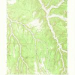
~ Tom Patterson Canyon UT topo map, 1:24000 scale, 7.5 X 7.5 Minute, Historical, 1966, updated 1970 on Sale
$14.95Original price was: $14.95.$7.48Current price is: $7.48.
