Search Product
Our Categories
Your Cart
Your order qualifies for free shipping!
Your shopping bag is currently empty
Continue Shopping
BEST SELLER


God Particle Wargaming Mat on Sale
Original price was: $54.95.$27.48Current price is: $27.48.Pleasant Surprise Spacebar Keycap For Discount
Original price was: $9.95.$4.98Current price is: $4.98.God Particle Extended Mousepad Online Hot Sale
Original price was: $36.95.$18.48Current price is: $18.48.Home Sweet Home Day Tote Online now
Original price was: $22.95.$11.48Current price is: $11.48.50%
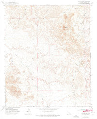
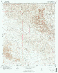
~ Picacho Peak CA topo map, 1:24000 scale, 7.5 X 7.5 Minute, Historical, 1965, updated 1975 Discount
Original price was: $14.95.$7.48Current price is: $7.48.
In Stock
Recently Viewed

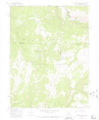
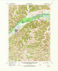
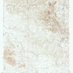
~ Meadow Creek Lake CO topo map, 1:24000 scale, 7.5 X 7.5 Minute, Historical, 1966, updated 1969 Discount
Original price was: $14.95.$7.48Current price is: $7.48.


Animal Print Extended Mousepad Sale
Original price was: $36.95.$18.48Current price is: $18.48.
Through The Wormhole Thin Desk Mat Discount
Original price was: $24.95.$12.48Current price is: $12.48.Description
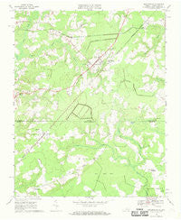
Picacho Peak, California, USGS topographic map dated 1965.
Includes geographic coordinates (latitude and longitude). This topographic map is suitable for hiking, camping, and exploring, or framing it as a wall map.
Printed on-demand using high resolution imagery, on heavy weight and acid free paper, or alternatively on a variety of synthetic materials.
Topos available on paper, Waterproof, Poly, or Tyvek. Usually shipping rolled, unless combined with other folded maps in one order.
- Product Number: USGS-5520695
- Free digital map download (high-resolution, GeoPDF): Picacho Peak, California (file size: 12 MB)
- Map Size: please refer to the dimensions of the GeoPDF map above
- Weight (paper map): ca. 55 grams
- Map Type: POD USGS Topographic Map
- Map Series: HTMC
- Map Verison: Historical
- Cell ID: 35010
- Scan ID: 294105
- Imprint Year: 1975
- Aerial Photo Year: 1962
- Field Check Year: 1965
- Datum: NAD27
- Map Projection: Polyconic
- Map published by United States Geological Survey
- Map Language: English
- Scanner Resolution: 600 dpi
- Map Cell Name: Picacho Peak
- Grid size: 7.5 X 7.5 Minute
- Date on map: 1965
- Map Scale: 1:24000
- Geographical region: California, United States
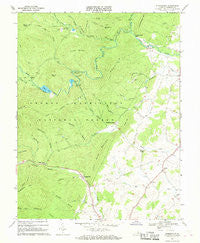
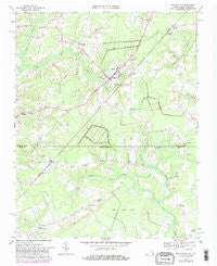
Neighboring Maps: