Search Product
Our Categories
Your Cart
Your order qualifies for free shipping!
Your shopping bag is currently empty
Continue Shopping
God Particle Wargaming Mat on Sale
Original price was: $54.95.$27.48Current price is: $27.48.
Pleasant Surprise Spacebar Keycap For Discount
Original price was: $9.95.$4.98Current price is: $4.98.


God Particle Extended Mousepad Online Hot Sale
Original price was: $36.95.$18.48Current price is: $18.48.
Home Sweet Home Day Tote Online now
Original price was: $22.95.$11.48Current price is: $11.48.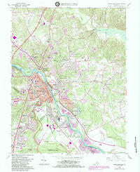
~ Fredericksburg VA topo map, 1:24000 scale, 7.5 X 7.5 Minute, Historical, 1966, updated 1984 Supply
Original price was: $14.95.$7.48Current price is: $7.48.
Recently Viewed

Li Hua Cat By the Christmas Tree House Flag For Discount
Original price was: $39.99.$20.00Current price is: $20.00.
Basenji King of Mardi Gras Throw Pillow For Cheap
Original price was: $39.99.$20.00Current price is: $20.00.Description
Fredericksburg, Virginia, USGS topographic map dated 1966.
Includes geographic coordinates (latitude and longitude). This topographic map is suitable for hiking, camping, and exploring, or framing it as a wall map.
Printed on-demand using high resolution imagery, on heavy weight and acid free paper, or alternatively on a variety of synthetic materials.
Topos available on paper, Waterproof, Poly, or Tyvek. Usually shipping rolled, unless combined with other folded maps in one order.
- Product Number: USGS-5298182
- Free digital map download (high-resolution, GeoPDF): Fredericksburg, Virginia (file size: 14 MB)
- Map Size: please refer to the dimensions of the GeoPDF map above
- Weight (paper map): ca. 55 grams
- Map Type: POD USGS Topographic Map
- Map Series: HTMC
- Map Verison: Historical
- Cell ID: 16313
- Scan ID: 185054
- Imprint Year: 1984
- Woodland Tint: Yes
- Photo Revision Year: 1984
- Aerial Photo Year: 1981
- Edit Year: 1984
- Field Check Year: 1966
- Datum: NAD27
- Map Projection: Polyconic
- Map published by United States Geological Survey
- Map Language: English
- Scanner Resolution: 600 dpi
- Map Cell Name: Fredericksburg
- Grid size: 7.5 X 7.5 Minute
- Date on map: 1966
- Map Scale: 1:24000
- Geographical region: Virginia, United States
- Map Area ID: AREA38.37538.25-77.5-77.375
- Northwest corner Lat Long code: USGSNW38.375-77.5
- Northeast corner Lat Long code: USGSNE38.375-77.375
- Southwest corner Lat Long code: USGSSW38.25-77.5
- Southeast corner Lat Long code: USGSSE38.25-77.375
- Northern map edge Latitude: 38.375
- Southern map edge Latitude: 38.25
- Western map edge Longitude: -77.5
- Eastern map edge Longitude: -77.375
-
Neighboring Maps:
Northwest North Northeast West MAP East Southwest South Southeast All neighboring USGS topo maps are available for sale online at a variety of scales.
Spatial coverage:
Topo map Fredericksburg, Virginia, covers the geographical area associated the following places:
– North Ferry Farms – Lansberry Park – Brookewood Farms – Misty Forest – Victoria Woods – Bourne – Hoyt – Light Oak Glen – Mount Pleasant Estates – Concord Heights – Boscobel – Chatham Farms – Dahlgren Junction (historical) – The Oaks at Ferry Farm – Debruyn – Stones Corner – Potomac – O Bannon Land – Highland Homes – Tylerton – Falmouth Bridge – Blaisdell Subdivision – White Oak – Colonial Heights – Hickory Ridge – White Oak Hills – Graninger Mobile Home Park – Little Creek – Walnut Hill – Heritage Commons – High School Heights – Ridge Pointe – Brooks – Fourmile Fork – Cranewood – Charlestown Commons – McCarthys Corner – Northridge – Fredericksburg – Butterfield – Cranes Corner – E O Brooks Subdivision – East Argyle Heights – Sullivan – Phillips – Belle Air Heights – Argyle Hills – Heather Hills – Ferry Farm – Artillery Ridge – Belmont Hills – Burnside – Cannon Ridge – Bridle Lake Estates – Blythedale – Wellford Sullivan Estate – Deer Forest – Bel Plains Estates – Belle Oaks – Woodlawn – Wildcat Corner – Chatam – New Hope Estates – Chatham Landing – Cottage Green – Leeland Station – Hart Division of Little Falls – Maryes Heights – Brookstone – Deacon Woods – Part Little Falls – Sweetbriar Woods – Leeland – Leeland Creek Estates – Braehead Woods – Lynwood – Ingleside – Boscobel Woods – Clarion Woods – Daffan – Grace Shelton Family Subdivision – Michaelbrooke Estates – Grafton Village – Sylvania Heights – Clearview Heights – Hillcrest Terrace – Chatham Village – Argyle Terrace – Confederate Ridge – East Chatham Heights – Huntington Hills – Hampstead Village – Argyle Heights – The Hills of Stafford – The Hills of Potomac Creek – Olde Forge – Fitzhugh – Chatham Heights – Fall Run Park – Kendallwood Estates
Additional information
Print Material Regular Paper, Waterproof, Polypropylene, Tyvek
Related products
50%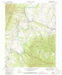
~ Stanley VA topo map, 1:24000 scale, 7.5 X 7.5 Minute, Historical, 1967, updated 1987 Fashion
Original price was: $14.95.$7.48Current price is: $7.48.50%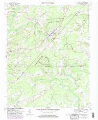
~ Whaleyville VA topo map, 1:24000 scale, 7.5 X 7.5 Minute, Historical, 1967, updated 1981 Supply
Original price was: $14.95.$7.48Current price is: $7.48.50%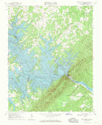
~ Smith Mountain Dam VA topo map, 1:24000 scale, 7.5 X 7.5 Minute, Historical, 1967, updated 1969 Online
Original price was: $14.95.$7.48Current price is: $7.48.50%
~ Tenth Legion VA topo map, 1:24000 scale, 7.5 X 7.5 Minute, Historical, 1967, updated 1987 For Discount
Original price was: $14.95.$7.48Current price is: $7.48.50%
~ Whaleyville VA topo map, 1:24000 scale, 7.5 X 7.5 Minute, Historical, 1967, updated 1981 Hot on Sale
Original price was: $14.95.$7.48Current price is: $7.48.50%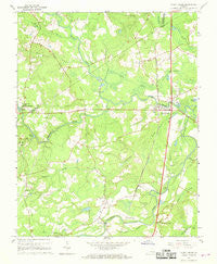
~ Stony Creek VA topo map, 1:24000 scale, 7.5 X 7.5 Minute, Historical, 1967, updated 1968 For Sale
Original price was: $14.95.$7.48Current price is: $7.48.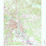
~ Fredericksburg VA topo map, 1:24000 scale, 7.5 X 7.5 Minute, Historical, 1966, updated 1984 Supply
Original price was: $14.95.$7.48Current price is: $7.48.